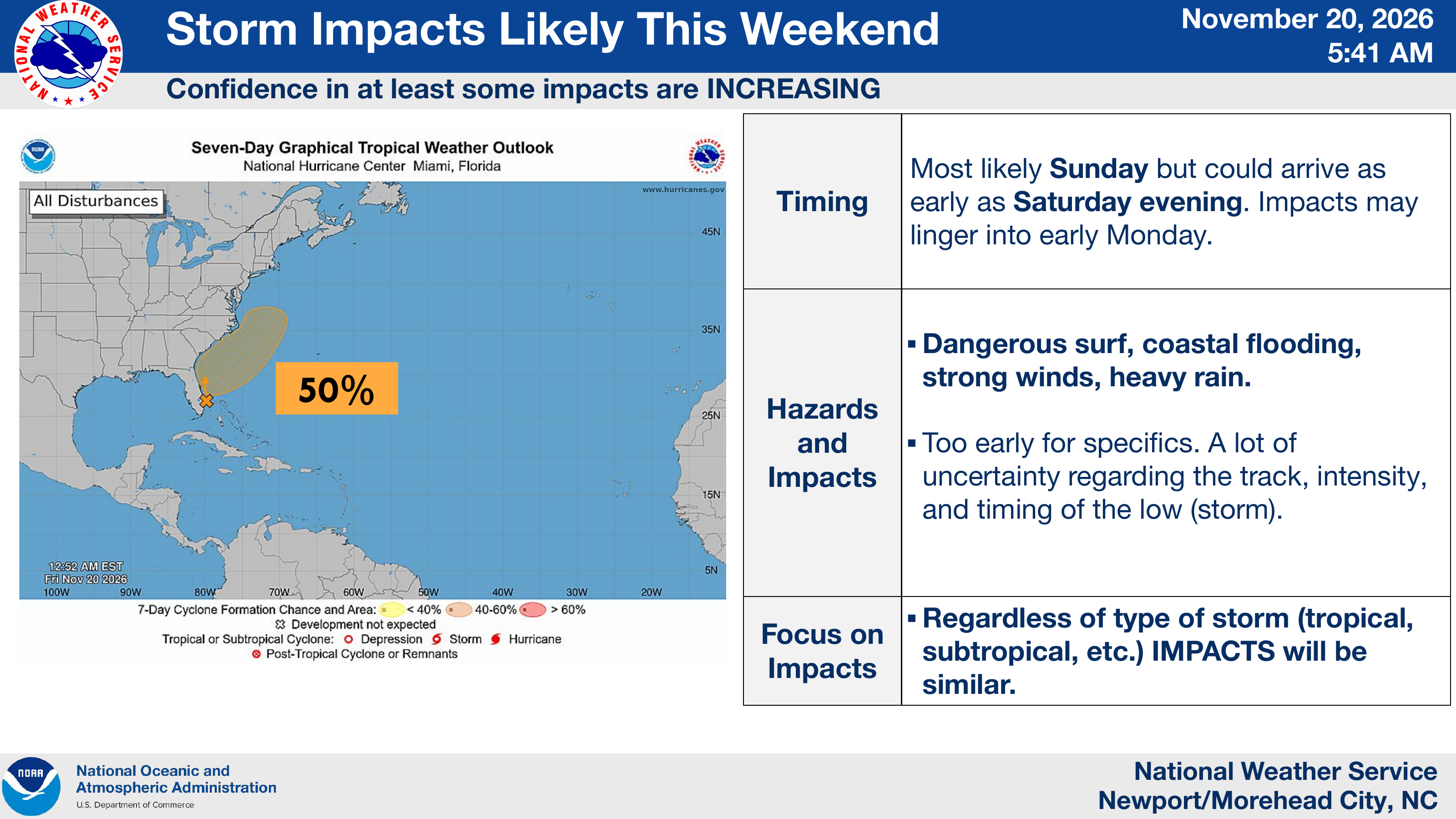
This morning’s briefing shows the seven-day chance of tropical or subtropical development has decreased from 60% to 50% since yesterday afternoon. Despite that change, the National Weather Service continues to report increasing confidence in at least some storm impacts across eastern North Carolina and the Outer Banks this weekend.
The expected timing and hazards remain unchanged. Impacts could begin Saturday evening, with Sunday still the most likely timing, and linger into early Monday. Dangerous surf, coastal flooding, strong winds and heavy rain remain possible.
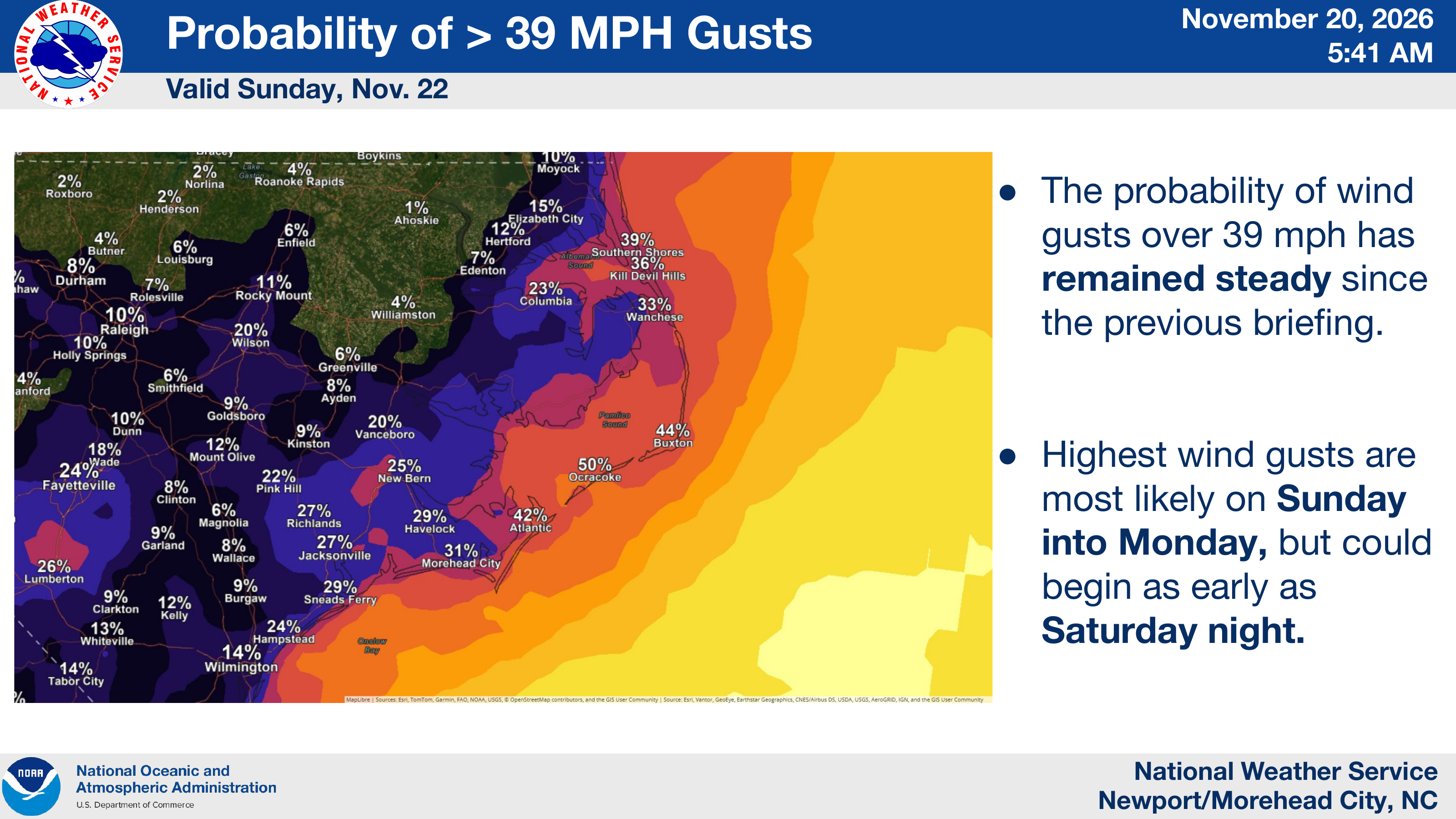
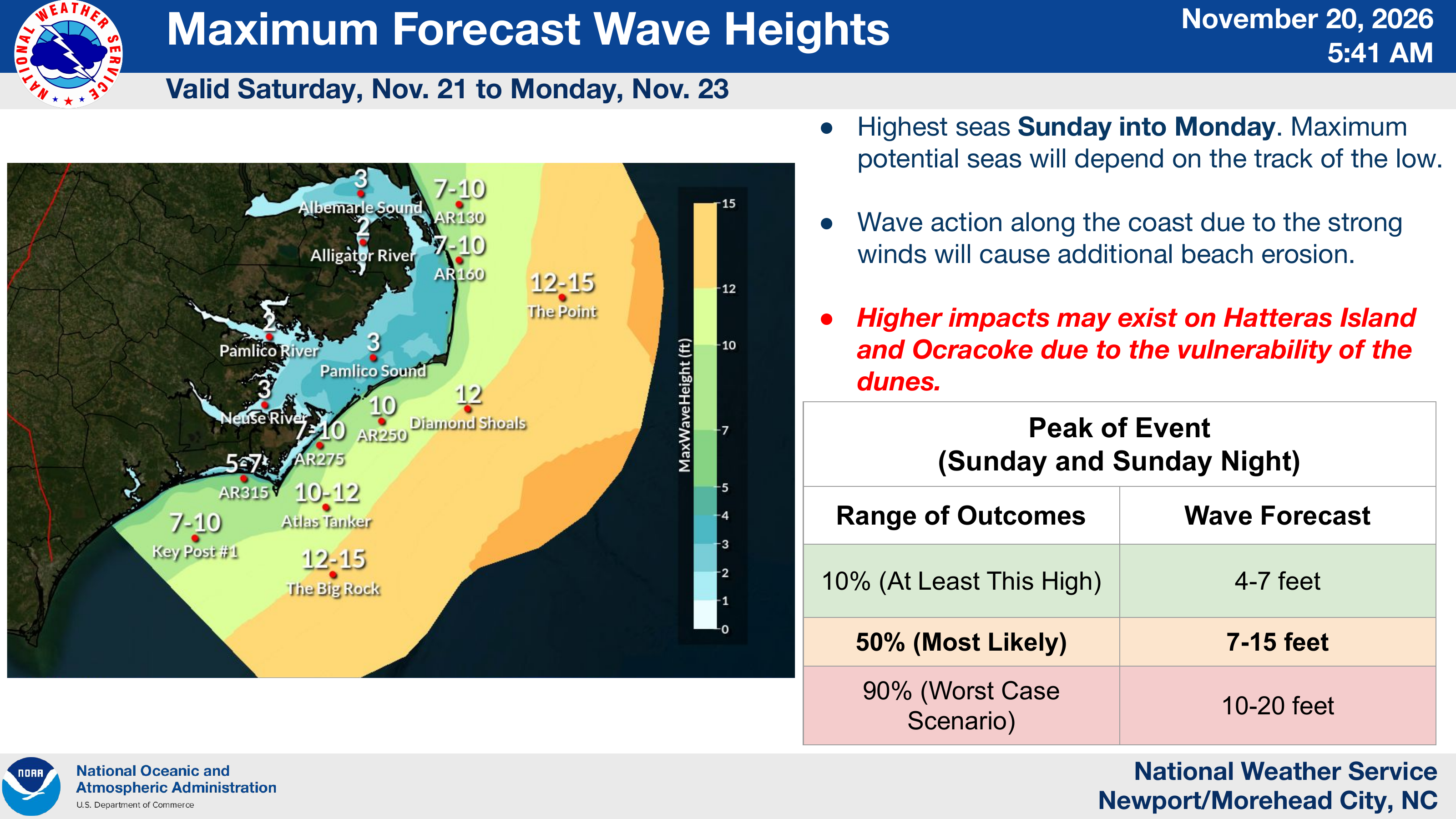
The probability of wind gusts exceeding 39 mph remains steady, and the most likely wave heights during the peak of the event Sunday and Sunday night remain 7–15 feet, with a worst-case scenario of 10–20 feet. Hatteras Island and Ocracoke remain particularly vulnerable to beach erosion and coastal impacts due to vulnerable dunes.
The storm’s track, intensity and timing remain uncertain. The NWS continues to emphasize focusing on the potential impacts regardless of whether the system becomes tropical or subtropical.
Source & credit
Credit: National Weather Service Newport/Morehead City, NC.